
|
112 Washington St. Claremont NH 03743 603-542-2503 |

|
Quick Searches:Claremont NH HomesNewport NH Homes Sunapee NH Homes |
 WishList |
||||||||||||||||||
|
|
||||||||||||||||||||||
|
|
112 Washington St. Claremont NH 03743 603-542-2503 |
|
Quick Searches:Claremont NH HomesNewport NH Homes Sunapee NH Homes |
WishList |
||||||||||||||||||
|
|
||||||||||||||||||||||
 |
Community Contact | Town of Newport Planning Department Julie Magnuson, Planning & Zoning Administrator 15 Sunapee Street, Municipal Building Newport, NH 03773 |
| Telephone | (603) 863-6278 | |
| Fax | (603) 863-8008 | |
| topaz@newportnh.net | ||
| Web Site | www.newportnh.net |
|
| Municipal Office Hours | Monday through Friday, 8 am - 5 pm; Town Clerk: Monday through Friday 8 am - 4:30 pm |
|
| County | Sullivan | |
| Labor Market Area | Newport NH LMA | |
| Tourism Region | Dartmouth-Lake Sunapee | |
| Planning Commission | Upper Valley/Lake Sunapee | |
| Regional Development | Capital Regional Development Council |
|
| Election Districts | ||
| US Congress | District 2 | |
| Executive Council | District 1 | |
| State Senate | District 8 | |
| State Representative | Sullivan County Districts 6, 9 |
|
Links to Community Information Sources and Services: |
 |
| Incorporated: 1761 |
| Origin: The first grant of this territory was in 1753 as Grenville, after George Grenville, William Pitt's brother-in-law. Few of the grantees were able to take up claim, and in 1761, the town was granted to a new group as Newport, in honor of Henry Newport, a distinguished English soldier and statesman. This group also had difficulty settling, and was granted a charter renewal in 1769. One of the most well-known people born in Newport was Sarah Josepha Buell Hale, daughter of innkeeper Gordon Buell. She was one of the first women editors in America who edited the book ?Poems for Children? that included Mary Had A Little Lamb. She made a successful appeal to President Lincoln for creation of a national holiday to be known as Thanksgiving Day. |
| Villages and Place Names: Chandlers Mills, Guild, Kelleyville, North Newport, Chandler Station |
| Population, Year of the First Census Taken: 780 residents in 1790 |
| Population Trends: Population change for Newport totaled 1,006 over 51 years, from 5,458 in 1960 to 6,464 in 2011. The largest decennial percent change was eight percent between 1960 and 1970; population decreased by two percent between 1980 and 1990. The 2011 Census estimate for Newport was 6,464 residents, which ranked 49th among New Hampshire's incorporated cities and towns. |
| Population Density and Land Area, 2010 (US Census Bureau): 149.4 persons per square mile of land area. Newport contains 43.6 square miles of land area and 0.08 square miles of inland water area. |
| MUNICIPAL SERVICES | |
|---|---|
| Type of Government | Selectmen |
| Budget: Municipal Appropriations, 2010 | $8,797,736 |
| Budget: School Appropriations, 2010 | $13,065,228 |
| Zoning Ordinance | 1965/12 |
| Master Plan | 2012 |
| Capitol Improvement Plan | Yes |
| Industrial Plans Reviewed By | Planning Board |
| Boards and Commissions | |
| Elected: | Selectmen |
| Appointed: | Planning; Conservation; Library; Zoning; Heritage; Airport; Recreation |
| Public Library | Richards Free |
| EMERGENCY SERVICES | ||
|---|---|---|
| Police Department | Full-time | |
| Fire Department | Municipal | |
| Emergency Medical Service | Municipal | |
| Nearest Hospital(s) | Distance | Staffed Beds |
| Valley Regional, Claremont | 11 miles | 25 |
| New London Hospital, New London | 13 miles | 25 |
| UTILITIES | |
|---|---|
| Electric Supplier | PSNH; NH Electric Coop; Conn. Valley |
| Natural Gas Supplier | None |
| Water Supplier | Newport Water Works |
| Sanitation | Municipal |
| Municipal Wastewater Treatment Plant | Yes |
| Solid Waste Disposal | |
| Curbside Trash Pickup | Private |
| Pay-As-You-Throw Program | No |
| Recycling Program | Voluntary |
| Telephone Company | Fairpoint |
| Cellular Telephone Access | Yes |
| Cable Television Access | Yes |
| Public Access Television Station | Yes |
| High Speed Internet Service: | |
| Business | Yes |
| Residential | Yes |
| (NH Dept. of Revenue Adminstration)PROPERTY TAXES | |
|---|---|
| 2011 Total Tax Rate (per $1,000 of value) | $25.37 |
| 2011 Equalization Ratio | 111.3 |
| 2011 Full Value Tax Rate (per $1,000 of value) | $28.20 |
| 2011 Percent of Local Assessed Value by Property Type | |
| Residential Land and Buildings | 72.6% |
| Commercial Land and Buildings | 24.5% |
| Public Utilities, Current Use, and Other | 2.8% |
| (ACS 2007-2011)HOUSING | |
|---|---|
| Total Housing Units | 2,961 |
| Single-Family Units, Detached or Attached | 1,730 |
| Units in Multiple-Family Structures: | |
| Two to Four Units in Structure | 445 |
| Five or More Units in Structure | 441 |
| Mobile Homes and Other Housing Units | 345 |
| (US Census Bureau)DEMOGRAPHICS | ||
|---|---|---|
| Total Population | Community | County |
| 2011 | 6,464 | 43,462 |
| 2010 | 6,507 | 43,742 |
| 2000 | 6,276 | 40,560 |
| 1990 | 6,095 | 38,652 |
| 1980 | 6,229 | 36,063 |
| 1970 | 5,899 | 30,949 |
| Demographics, American Community Survey (ACS) 2007-2011 | ||
| Population by Gender | ||
| Male: 3,070 | Female: 3,451 | |
| Population by Age Group | ||
| Under age 5 | 285 | |
| Age 5 to 19 | 1,338 | |
| Age 20 to 34 | 999 | |
| Age 35 to 54 | 1,936 | |
| Age 55 to 64 | 948 | |
| Age 65 and over | 1,015 | |
| Median Age | 44.2 years | |
| Educational Attainment, population 25 years and over | ||
| High school graduate or higher | 87.1% | |
| Bachelor's degree or higher | 19.5% | |
| (ACS 2007-2011)INCOME, 2011 INFLATION ADJUSTED $ | |
|---|---|
| Per capita income | $22,370 |
| Median family income | $56,469 |
| Median household income | $43,163 |
| Median Earnings, full-time, year-round workers | |
| Male | $37,239 |
| Female | $37,841 |
| Families below the poverty level | 10.0% |
| (NHES - ELMI)LABOR FORCE | ||
|---|---|---|
| Annual Average | 2001 | 2011 |
| Civilian Labor Force | 3,098 | 2,740 |
| Employed | 3,010 | 2,561 |
| Unemployed | 88 | 179 |
| Unemployment Rate | 2.8% | 6.5% |
| (NHES - ELMI)EMPLOYMENT & WAGES | ||
|---|---|---|
| Annual Average Covered Employment | 2001 | 2011 |
| Goods Producing Industries | ||
| Average Employment | 1,800 | 1,215 |
| Average Weekly Wage | $704 | $1,134 |
| Service Providing Industries | ||
| Average Employment | 1,498 | 1,537 |
| Average Weekly Wage | $453 | $596 |
| Total Private Industry | ||
| Average Employment | 3,298 | 2,752 |
| Average Weekly Wage | $590 | $833 |
| Government (Federal, State, and Local) | ||
| Average Employment | 761 | 446 |
| Average Weekly Wage | $454 | $687 |
| Total, Private plus Government | ||
| Average Employment | 4,059 | 3,198 |
| Average Weekly Wage | $564 | $813 |
| n = indicates that the data does not meet disclosure standards | ||
| (NH Dept. of Education)EDUCATION/CHILD CARE FACILITIES | ||||
|---|---|---|---|---|
| Schools students attend: | Newport operates grades K-12 | SAU 43 | ||
| Career Technology Center(s): | Sugar River Valley Technical Center, Newport or Claremont | Region: 10 | ||
| Educational Facilities | Elementary | Middle/Junior High | High School | Private/Parochial |
| Number of Schools | 2 | 1 | 1 | 2 |
| Grade Levels | P K 1-6 | 7-8 | 9-12 | P K 1-12 |
| Total Enrollment | 538 | 150 | 352 | 87 |
| 2012 NH Licensed Child Care Facilities (Bureau of Child Care Licensing): | Total Facilities: 6 | Total Capacity: 198 | ||
| Nearest Community/Technical College: River Valley | ||||
| Nearest Colleges or Universities: Dartmouth; Colby-Sawyer | ||||
| LARGEST BUSINESSES | PRODUCT/SERVICE | EMPLOYEES | ESTABLISHED |
|---|---|---|---|
| Sturm Ruger & Co. | Sporting firearms | 818 | 1949 |
| LaValley Building Supply | Building components | 100 | 1962 |
| Lake Sunapee Bank | Banking services | 95 | |
| Hartford Eichenauer, Inc. | Heating elements | 70 | 1982 |
| Latva Machine Co., Inc. | Precision machine parts | 97 | 1979 |
| United Construction | Construction contractor | 63 | 1960 |
| Carroll Concrete | Concrete products | 51 | 1959 |
| Sugar River Bank | Banking services | 55 | |
| Premier Precision | Machine parts | 90 | |
| (Distance estimated from city/town hall)TRANSPORTATION | |||
|---|---|---|---|
| Road Access | US Routes | ||
| State Routes | 10, 11, 103 | ||
| Nearest Interstate, Exit | I-89, Exits 12A - 13 | ||
| Distance | 10 miles | ||
| Railroad | No | ||
| Public Transportation | CTS | ||
| Nearest Public Use Airport, General Aviation | |||
| Parlin Field, Newport | |||
| Runway | 3,450 ft. asphalt | ||
| Lighted? | No | Navigational Aids? | No |
| Nearest Airport with Scheduled Service | |||
| Lebanon Municipal | Distance | 29 miles | |
| Number of Passsenger Airlines Serving Airport | 1 | ||
| Driving distance to selected cities: | |||
| Manchester, NH | 53 miles | ||
| Portland, ME | 146 miles | ||
| Boston, MA | 111 miles | ||
| New York City, NY | 260 miles | ||
| Montreal, Quebec | 212 miles | ||
| (ACS 2007-2011)COMMUTING TO WORK | |||
|---|---|---|---|
| Workers 16 years and over | |||
| Drove alone, car/truck/van | 79.5% | ||
| Carpooled, car/truck/van | 10.9% | ||
| Public transportation | 0.0% | ||
| Walked | 5.1% | ||
| Other Means | 0.0% | ||
| Worked at home | 4.5% | ||
| Mean Travel Time to Work | 19.9 minutes | ||
| Percent of Working Residents: | (ACS 2007-2011) | ||
| Working in community of residence | 77.3% | ||
| Commuting to another NH community | 19.1% | ||
| Commuting out-of-state | 3.6% | ||
| RECREATION, ATTRACTIONS, AND EVENTS | |
|---|---|
| X | Municipal Parks |
| YMCA/YWCA | |
| Boys Club/Girls Club | |
| X | Golf Courses |
| Swimming: Indoor Facility | |
| Swimming: Outdoor Facility | |
| X | Tennis Courts: Indoor Faclity |
| X | Tennis Courts: Outdoor Facility |
| Ice Skating Rink: Indoor Facility | |
| X | Bowling Facilities |
| X | Museums |
| Cinemas | |
| X | Performing Arts Facilities |
| X | Tourists Attractions |
| X | Youth Organizations (i.e., Scouts, 4-H) |
| X | Youth Sports: Baseball |
| X | Youth Sports: Soccer |
| X | Youth Sports: Football |
| X | Youth Sports: Basketball |
| X | Youth Sports: Hockey |
| X | Campgrounds |
| X | Fishing/Hunting |
| X | Boating/Marinas |
| X | Snowmobile Trails |
| X | Bicycle Trails |
| X | Cross Country Skiing |
| X | Beach or Waterfront Recreational Area |
| Overnight or Day Camps | |
| Nearest Ski Area(s): Mount Sunapee | |
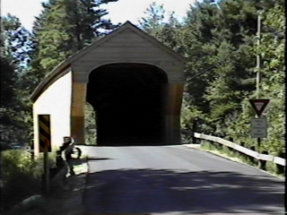
| Other: Covered Bridges; Lake Sunapee; Parlin Field Airport; Rails to Trails; Sugar River; Outdoor Ice Skating Rink; Team Pinnacle Events; Winter Carnival; Farmer's Market; Concerts on The Common; Library Arts Center Exhibits | |
Economic & Labor Market Information Bureau, NH Employment Security, 2013.
Community Response Received 07/18/12
All information regarding the communities is from sources deemed reliable and is submitted subject to errors, omissions, modifications, and withdrawals without notice. No warranty or representation is made as to the accuracy of the information contained herein. Specific questions regarding individual cities and towns should be directed to the community contact.
| Coldwell Banker Homes Unlimited Real Estate | |||||
|---|---|---|---|---|---|
|
|
Copyright © 2024 PrimeMLS, Inc. All rights reserved. This information is deemed reliable, but not guaranteed. The data relating to real estate displayed on this display comes in part from the IDX Program of PrimeMLS. The information being provided is for consumers’ personal, non-commercial use and may not be used for any purpose other than to identify prospective properties consumers may be interested in purchasing. Data last updated April 19th, 2024 Copyright © 2024 JJ Ranney Realty, LLC. All Rights Reserved. Coldwell Banker® and the Coldwell Banker Logo are registered service marks owned by Coldwell Banker Real Estate LLC. JJ Ranney Realty, LLC fully supports the principles of the Fair Housing Act and the Equal Opportunity Act. Each franchise is independently owned and operated. Any services or products provided by independently owned and operated franchisees are not provided by, affiliated with or related to Coldwell Banker Real Estate LLC nor any of its affiliated companies.
|
 |
|||