|
112 Washington St. Claremont NH 03743 603-542-2503 |

|
Quick Searches:Claremont NH HomesNewport NH Homes Sunapee NH Homes |
 WishList |
||||||||||||||||||
|
|
||||||||||||||||||||||
|
|
112 Washington St. Claremont NH 03743 603-542-2503 |
|
Quick Searches:Claremont NH HomesNewport NH Homes Sunapee NH Homes |
WishList |
||||||||||||||||||
|
|
||||||||||||||||||||||
 |
Community Contact | City of Claremont Nancy Merrill, Planning & Development Director 14 North Street Claremont, NH 03743 |
| Telephone | (603) 542-7030 | |
| Fax | (603) 542-7033 | |
| visitor@claremontnh.com | ||
| Web Site | www.claremontnh.com |
|
| Municipal Office Hours | Monday through Friday, 8:30 am - 5 pm |
|
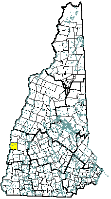
| County | Sullivan | |
| Labor Market Area | Claremont NH Micro-NECTA | |
| Tourism Region | Dartmouth-Lake Sunapee | |
| Planning Commission | Upper Valley/Lake Sunapee | |
| Regional Development | Capital Regional Development Council |
|
| Election Districts | ||
| US Congress | District 2 (All Wards) | |
| Executive Council | District 1 (All Wards) | |
| State Senate | District 8 (All Wards) | |
| State Representative | Sullivan County Districts 3, 10 (Ward 1) 4, 10 (Ward 2) 5, 10 (Ward 3) |
| Incorporated: 1764 |
| Origin: Claremont takes its name from Claremont Castle, an English palace named in honor of John Holles, the first Earl of Clare. The castle was built under the direction of Thomas Pelham Holles, who was involved in relations between the American Colonies and England, and a cousin to Governor Benning Wentworth. Claremont's original land grant was a six-mile square area bordering the Connecticut River, including the governor's farm. The first Roman Catholic Church in New Hampshire was built in Claremont in 1823. |
| Villages and Place Names: Claremont Junction, Puckershire, West Claremont |
| Population, Year of the First Census Taken: 1,435 residents in 1790 |
| Population Trends: Population in Claremont decreased by 295 percent over 51 years, from 13,563 in 1960 to 13,268 in 2011. The largest decennial percent change was a five percent increase between 1960 and 1970. The 2011 Census estimate for Claremont was 13,268 residents, which ranked 22nd among New Hampshire's incorporated cities and towns. |
| Population Density and Land Area, 2010 (US Census Bureau): 309.7 persons per square mile of land area. Claremont contains 43.1 square miles of land area and 1.0 square miles of inland water area. |
| MUNICIPAL SERVICES | |
|---|---|
| Type of Government | Manager & Council |
| Budget: Municipal Appropriations, 2012 | $19,861,137 |
| Budget: School Appropriations, 2011 | $31,539,153 |
| Zoning Ordinance | 1952/04 |
| Master Plan | 2011 |
| Capitol Improvement Plan | Yes |
| Industrial Plans Reviewed By | Planning Board |
| Boards and Commissions | |
| Elected: | City Council |
| Appointed: | Airport Advisory; Appeals; Goodwin Community Center; Planning; Zoning; Library; Conservation; Historic District; Parks & Recreation; Claremont Development Authority |
| Public Library | Fiske Free |
| EMERGENCY SERVICES | ||
|---|---|---|
| Police Department | Full-time | |
| Fire Department | Full-time | |
| Emergency Medical Service | Municipal | |
| Nearest Hospital(s) | Distance | Staffed Beds |
| Valley Regional, Claremont | Local | 25 |
| UTILITIES | |
|---|---|
| Electric Supplier | PSNH; NH Electric Coop |
| Natural Gas Supplier | None |
| Water Supplier | Claremont Water Department |
| Sanitation | Municipal |
| Municipal Wastewater Treatment Plant | Yes |
| Solid Waste Disposal | |
| Curbside Trash Pickup | Private |
| Pay-As-You-Throw Program | Yes |
| Recycling Program | Voluntary |
| Telephone Company | Verizon |
| Cellular Telephone Access | Yes |
| Cable Television Access | Yes |
| Public Access Television Station | Yes |
| High Speed Internet Service: | |
| Business | Yes |
| Residential | Yes |
| (NH Dept. of Revenue Adminstration)PROPERTY TAXES | |
|---|---|
| 2011 Total Tax Rate (per $1,000 of value) | $33.18 |
| 2011 Equalization Ratio | 100.0 |
| 2011 Full Value Tax Rate (per $1,000 of value) | $31.11 |
| 2011 Percent of Local Assessed Value by Property Type | |
| Residential Land and Buildings | 71.8% |
| Commercial Land and Buildings | 26.0% |
| Public Utilities, Current Use, and Other | 2.2% |
| (ACS 2007-2011)HOUSING | |
|---|---|
| Total Housing Units | 6,301 |
| Single-Family Units, Detached or Attached | 3,183 |
| Units in Multiple-Family Structures: | |
| Two to Four Units in Structure | 1,352 |
| Five or More Units in Structure | 1,338 |
| Mobile Homes and Other Housing Units | 428 |
| (US Census Bureau)DEMOGRAPHICS | ||
|---|---|---|
| Total Population | Community | County |
| 2011 | 13,268 | 43,462 |
| 2010 | 13,355 | 43,742 |
| 2000 | 13,154 | 40,560 |
| 1990 | 13,947 | 38,652 |
| 1980 | 14,557 | 33,063 |
| 1970 | 14,221 | 30,949 |
| Demographics, American Community Survey (ACS) 2007-2011 | ||
| Population by Gender | ||
| Male: 6,693 | Female: 6,729 | |
| Population by Age Group | ||
| Under age 5 | 986 | |
| Age 5 to 19 | 2,387 | |
| Age 20 to 34 | 2,574 | |
| Age 35 to 54 | 3,734 | |
| Age 55 to 64 | 1,559 | |
| Age 65 and over | 2,182 | |
| Median Age | 40.0 years | |
| Educational Attainment, population 25 years and over | ||
| High school graduate or higher | 88.5% | |
| Bachelor's degree or higher | 13.7% | |
| (ACS 2007-2011)INCOME, 2011 INFLATION ADJUSTED $ | |
|---|---|
| Per capita income | $21,853 |
| Median family income | $47,813 |
| Median household income | $38,846 |
| Median Earnings, full-time, year-round workers | |
| Male | $39,505 |
| Female | $31,707 |
| Families below the poverty level | 13.1% |
| (NHES - ELMI)LABOR FORCE | ||
|---|---|---|
| Annual Average | 2001 | 2011 |
| Civilian Labor Force | 6,825 | 6,794 |
| Employed | 6,630 | 6,436 |
| Unemployed | 195 | 358 |
| Unemployment Rate | 2.9% | 5.3% |
| (NHES - ELMI)EMPLOYMENT & WAGES | ||
|---|---|---|
| Annual Average Covered Employment | 2001 | 2011 |
| Goods Producing Industries | ||
| Average Employment | 1,458 | n |
| Average Weekly Wage | $678 | n |
| Service Providing Industries | ||
| Average Employment | 3,722 | n |
| Average Weekly Wage | $474 | n |
| Total Private Industry | ||
| Average Employment | 5,179 | 4,905 |
| Average Weekly Wage | $531 | $687 |
| Government (Federal, State, and Local) | ||
| Average Employment | 743 | 912 |
| Average Weekly Wage | $567 | $717 |
| Total, Private plus Government | ||
| Average Employment | 5,923 | 5,817 |
| Average Weekly Wage | $536 | $692 |
| n = indicates that the data does not meet disclosure standards | ||
| (NH Dept. of Education)EDUCATION/CHILD CARE FACILITIES | ||||
|---|---|---|---|---|
| Schools students attend: | Claremont operates grades K-12 | SAU 6 | ||
| Career Technology Center(s): | Sugar River Valley Technical Center, Newport or Claremont | Region: 10 | ||
| Educational Facilities | Elementary | Middle/Junior High | High School | Private/Parochial |
| Number of Schools | 3 | 1 | 1 | 2 |
| Grade Levels | P K 1-5 | 6-8 | 9-12 | P K 1-12 |
| Total Enrollment | 870 | 421 | 632 | 162 |
| 2012 NH Licensed Child Care Facilities (Bureau of Child Care Licensing): | Total Facilities: 16 | Total Capacity: 570 | ||
| Nearest Community/Technical College: River Valley | ||||
| Nearest Colleges or Universities: Colby-Sawyer; Magdalen; Dartmouth | ||||
| LARGEST BUSINESSES | PRODUCT/SERVICE | EMPLOYEES | ESTABLISHED |
|---|---|---|---|
| Valley Regional Health Care | Health care services | 334 | 1893 |
| Claremont School District | Education | 407 | 1867 |
| Wal-Mart | Retail store | 172 | 1993 |
| City of Claremont | Municipal services | 127 | 1762 |
| Red River Computers | Technology | 68 | 1995 |
| Crown Point Cabinetry | Custom Cabinetry | 86 | 1978 |
| National Field Representatives | Mortgage services | 131 | 1989 |
| Claremont Savings Bank | Banking services | 95 | 1907 |
| Structal-Bridges | Manufacturing | 140 | 2007 |
| Pathways | Human services | 157 |
| (Distance estimated from city/town hall)TRANSPORTATION | |||
|---|---|---|---|
| Road Access | US Routes | ||
| State Routes | 11, 12, 103, 120 | ||
| Nearest Interstate, Exit | I-91 (VT), Exit 8 | ||
| Distance | 5 miles | ||
| Railroad | Amtrak, B & M, CCRR | ||
| Public Transportation | CTS | ||
| Nearest Public Use Airport, General Aviation | |||
| Claremont Municipal | |||
| Runway | 3,100 ft. asphalt | ||
| Lighted? | Yes | Navigational Aids? | Yes |
| Nearest Airport with Scheduled Service | |||
| Lebanon Municipal | Distance | 24 miles | |
| Number of Passsenger Airlines Serving Airport | 1 | ||
| Driving distance to selected cities: | |||
| Manchester, NH | 71 miles | ||
| Portland, ME | 163 miles | ||
| Boston, MA | 121 miles | ||
| New York City, NY | 250 miles | ||
| Montreal, Quebec | 206 miles | ||
| (ACS 2007-2011)COMMUTING TO WORK | |||
|---|---|---|---|
| Workers 16 years and over | |||
| Drove alone, car/truck/van | 77.5% | ||
| Carpooled, car/truck/van | 11.3% | ||
| Public transportation | 0.4% | ||
| Walked | 3.7% | ||
| Other Means | 2.7% | ||
| Worked at home | 4.3% | ||
| Mean Travel Time to Work | 22.3 minutes | ||
| Percent of Working Residents: | (ACS 2007-2011) | ||
| Working in community of residence | 63.1% | ||
| Commuting to another NH community | 22.4% | ||
| Commuting out-of-state | 14.4% | ||
| RECREATION, ATTRACTIONS, AND EVENTS | |
|---|---|
| X | Municipal Parks |
| YMCA/YWCA | |
| X | Boys Club/Girls Club |
| X | Golf Courses |
| X | Swimming: Indoor Facility |
| X | Swimming: Outdoor Facility |
| Tennis Courts: Indoor Faclity | |
| X | Tennis Courts: Outdoor Facility |
| Ice Skating Rink: Indoor Facility | |
| X | Bowling Facilities |
| X | Museums |
| X | Cinemas |
| X | Performing Arts Facilities |
| X | Tourists Attractions |
| X | Youth Organizations (i.e., Scouts, 4-H) |
| X | Youth Sports: Baseball |
| X | Youth Sports: Soccer |
| X | Youth Sports: Football |
| X | Youth Sports: Basketball |
| X | Youth Sports: Hockey |
| Campgrounds | |
| X | Fishing/Hunting |
| X | Boating/Marinas |
| X | Snowmobile Trails |
| X | Bicycle Trails |
| X | Cross Country Skiing |
| X | Beach or Waterfront Recreational Area |
| Overnight or Day Camps | |
| Nearest Ski Area(s): Okemo (VT), Mount Sunapee, Arrowhead | |
| Other: Youth LaCrosse; Historic Opera House; ATV; Hiking; Snowshoeing | |
Economic & Labor Market Information Bureau, NH Employment Security, 2013.
Community Response Received 07/11/12
All information regarding the communities is from sources deemed reliable and is submitted subject to errors, omissions, modifications, and withdrawals without notice. No warranty or representation is made as to the accuracy of the information contained herein. Specific questions regarding individual cities and towns should be directed to the community contact.
| Coldwell Banker Homes Unlimited Real Estate | |||||
|---|---|---|---|---|---|
|
|
Copyright © 2024 PrimeMLS, Inc. All rights reserved. This information is deemed reliable, but not guaranteed. The data relating to real estate displayed on this display comes in part from the IDX Program of PrimeMLS. The information being provided is for consumers’ personal, non-commercial use and may not be used for any purpose other than to identify prospective properties consumers may be interested in purchasing. Data last updated April 17th, 2024 Copyright © 2024 JJ Ranney Realty, LLC. All Rights Reserved. Coldwell Banker® and the Coldwell Banker Logo are registered service marks owned by Coldwell Banker Real Estate LLC. JJ Ranney Realty, LLC fully supports the principles of the Fair Housing Act and the Equal Opportunity Act. Each franchise is independently owned and operated. Any services or products provided by independently owned and operated franchisees are not provided by, affiliated with or related to Coldwell Banker Real Estate LLC nor any of its affiliated companies.
|
 |
|||