
|
112 Washington St. Claremont NH 03743 603-542-2503 |

|
Quick Searches:Claremont NH HomesNewport NH Homes Sunapee NH Homes |
 WishList |
||||||||||||||||||
|
|
||||||||||||||||||||||
|
|
112 Washington St. Claremont NH 03743 603-542-2503 |
|
Quick Searches:Claremont NH HomesNewport NH Homes Sunapee NH Homes |
WishList |
||||||||||||||||||
|
|
||||||||||||||||||||||
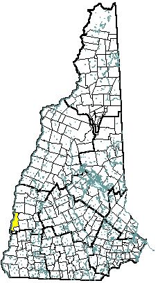 |
Community Contact | Charlestown Selectboard Brenda Ferland, Chair PO Box 385 Charlestown, NH 03603 |
| Telephone | (603) 826-4400 | |
| Fax | (603) 826-3709 | |
| dedkins@charlestown-nh.gov | ||
| Web Site | www.charlestown-nh.gov |
|
| Municipal Office Hours | Monday through Friday, 8 am - 4 pm; Selectmen: Monday, Wednesday, 8 am - 6 pm, Tuesday, Thursday, Friday, 8 am - 4 pm; Town Clerk, Tax Collector: Monday, 8 am - 1 pm, 1:30 pm - 6 pm, Tuesday through Friday, 8 am - 1 pm, 1:30 pm - 4 pm |
|
| County | Sullivan | |
| Labor Market Area | Charlestown NH LMA | |
| Tourism Region | Dartmouth-Lake Sunapee | |
| Planning Commission | Upper Valley Lake Sunapee | |
| Regional Development | Capital Regional Development Council |
|
| Election Districts | ||
| US Congress | District District 2 | |
| Executive Council | District District 2 | |
| State Senate | District District 5 | |
| State Representative | Sullivan County Districts 8, 11 |
| Incorporated: 1753 |
| Origin: Charlestown was originally the site of Number Four, the fourth in a line of forts on the Connecticut River border established as trading posts by Massachusetts Governor Belcher in 1735. In 1753, Governor Benning Wentworth named the town in honor of his friend, Admiral Sir Charles Knowles of the British Navy, who was then governor of Jamaica. A reproduction of Old Fort Number Four is now a historical site and museum. A historical marker commemorating the fort was erected in 1958ùthe second marker in the NH Historical Marker Program. |
| Villages and Place Names: Hemlock Center, North Charlestown, Snumshire, South Charlestown, South Hemlock, Springfield Junction, Trapshire |
| Population, Year of the First Census Taken: 1,093 residents in 1790 |
| Population Trends: Population change for Charlestown totaled 2,405 over 53 years, from 2,576 in 1960 to 4,981 in 2013. The largest decennial percent change was a 35 percent increase between 1970 and 1980; after that, decennial percent change was seven percent or less. The 2013 Census estimate for Charlestown was 4,981 residents, which ranked 69th among New Hampshire's incorporated cities and towns. |
| Population Density and Land Area, 2013 (US Census Bureau): 139.1 persons per square mile of land area. Charlestown contains 35.8 square miles of land area and 2.2 square miles of inland water area. |
| MUNICIPAL SERVICES | |
|---|---|
| Type of Government | Selectmen |
| Budget: Municipal Appropriations, 2014 | $4,793,879 |
| Budget: School Appropriations, 2014-2015 | $17,030,560 |
| Zoning Ordinance | 1951/12 |
| Master Plan | 2007 |
| Capitol Improvement Plan | No |
| Industrial Plans Reviewed By | Planning Board |
| Boards and Commissions | |
| Elected: | Selectboard; Planning; Finance; Library; Cemetery; Highway Advisory; Recreation |
| Appointed: | Zoning; Conservation; Heritage |
| Public Library | Silsby Free Public |
| EMERGENCY SERVICES | ||
|---|---|---|
| Police Department | Full-time | |
| Fire Department | On-Call | |
| Emergency Medical Service | On-Call | |
| Nearest Hospital(s) | Distance | Staffed Beds |
| Valley Regional, Claremont | 13 miles | 25 |
| Mt. Ascutney Hospital, Windsor VT | 19 miles | 33 |
| UTILITIES | |
|---|---|
| Electric Supplier | PSNH; National Grid; NH Electric Coop |
| Natural Gas Supplier | None |
| Water Supplier | Charlestown Municipal Water Department |
| Sanitation | Municipal |
| Municipal Wastewater Treatment Plant | Yes |
| Solid Waste Disposal | |
| Curbside Trash Pickup | None |
| Pay-As-You-Throw Program | No |
| Recycling Program | Mandatory: glass, cardboard only & voluntary for other recyclables |
| Telephone Company | Fairpoint |
| Cellular Telephone Access | Yes |
| Cable Television Access | Yes |
| Public Access Television Station | No |
| High Speed Internet Service: | |
| Business | Yes |
| Residential | Yes |
| (NH Dept. of Revenue Adminstration) PROPERTY TAXES | |
|---|---|
| 2013 Total Tax Rate (per $1,000 of value) | $32.28 |
| 2013 Equalization Ratio | 107.7 |
| 2013 Full Value Tax Rate (per $1,000 of value) | $34.38 |
| 2013 Percent of Local Assessed Value by Property Type | |
| Residential Land and Buildings | 83.3% |
| Commercial Land and Buildings | 13.2% |
| Public Utilities, Current Use, and Other | 3.5% |
| (ACS 2008-2012) HOUSING | |
|---|---|
| Total Housing Units | 2,452 |
| Single-Family Units, Detached or Attached | 1,336 |
| Units in Multiple-Family Structures: | |
| Two to Four Units in Structure | 144 |
| Five or More Units in Structure | 195 |
| Mobile Homes and Other Housing Units | 777 |
| (US Census Bureau) DEMOGRAPHICS | ||
|---|---|---|
| Total Population | Community | County |
| 2013 | 5,009 | 43,074 |
| 2010 | 5,114 | 43,742 |
| 2000 | 4,761 | 40,560 |
| 1990 | 4,637 | 38,652 |
| 1980 | 4,417 | 36,063 |
| 1970 | 3,274 | 30,949 |
| Demographics, American Community Survey (ACS) 2008-2012 | ||
| Population by Gender | ||
| Male: 2,440 | Female: 2,641 | |
| Population by Age Group | ||
| Under age 5 | 258 | |
| Age 5 to 19 | 800 | |
| Age 20 to 34 | 807 | |
| Age 35 to 54 | 1,635 | |
| Age 55 to 64 | 782 | |
| Age 65 and over | 799 | |
| Median Age | 47 years | |
| Educational Attainment, population 25 years and over | ||
| High school graduate or higher | 86.4% | |
| Bachelor's degree or higher | 12.9% | |
| (ACS 2008-2012) ANNUAL INCOME, 2012 (Inflation Adjusted Dollars) |
|
|---|---|
| Per capita income | $24,250 |
| Median family income | $58,802 |
| Median household income | $49,688 |
| Median Earnings, full-time, year-round workers | |
| Male | $42,049 |
| Female | $36,158 |
| Individuals below the poverty level | 9% |
| (NHES - ELMI) LABOR FORCE | ||
|---|---|---|
| Annual Average | 2003 | 2013 |
| Civilian Labor Force | 2,387 | 2,733 |
| Employed | 2,292 | 2,590 |
| Unemployed | 95 | 143 |
| Unemployment Rate | 4% | 5.2% |
| (NHES - ELMI) EMPLOYMENT & WAGES | ||
|---|---|---|
| Annual Average Covered Employment | 2003 | 2013 |
| Goods Producing Industries | ||
| Average Employment | 801 | 1,005 |
| Average Weekly Wage | $625 | $938 |
| Service Providing Industries | ||
| Average Employment | 565 | 684 |
| Average Weekly Wage | $605 | $678 |
| Total Private Industry | ||
| Average Employment | 1,365 | 1,688 |
| Average Weekly Wage | $617 | $833 |
| Government (Federal, State, and Local) | ||
| Average Employment | 454 | 221 |
| Average Weekly Wage | $585 | $631 |
| Total, Private plus Government | ||
| Average Employment | 1,819 | 1,909 |
| Average Weekly Wage | $609 | $809 |
| (NH Dept. of Education) EDUCATION/CHILD CARE FACILITIES | ||||
|---|---|---|---|---|
| Schools students attend: | Grades K-12 are part of Fall Mountain Regional (Acworth, Alstead, Charlestown, Langdon, Walpole) | SAU 60 | ||
| Career Technology Center(s): | The Cheshire Career Center, Keene; Fall Mountain Regional High School - CTE, Langdon; Windham Regional Career Center, Brattleboro, VT | Region: 13 | ||
| Educational Facilities | Elementary | Middle/Junior High | High School | Private/Parochial |
| Number of Schools | 2 | 1 | ||
| Grade Levels | K 1-5 | 8-Jun | ||
| Total Enrollment | 305 | 143 | ||
| 2014 NH Licensed Child Care Facilities (Bureau of Child Care Licensing): | Total Facilities: 6 | Total Capacity: 107 | ||
| Nearest Community/Technical College: River Valley | ||||
| Nearest Colleges or Universities: Keene State; Antioch New England | ||||
| LARGEST BUSINESSES | PRODUCT/SERVICE | EMPLOYEES | ESTABLISHED |
|---|---|---|---|
| Whelen Engineering | Emergency lights | 800 | 1952 |
| Bomar, Inc. | Marine hardware | 80 | 1974 |
| Design Standards, Inc | Medical instruments | 93 | 1979 |
| Connecticut River Bank | Banking services | 45 | 1864 |
| G K N Aerospace | Aircraft engine parts | 55 | 1979 |
| Airgas, Inc | Welding equip., industrial & medical gases | 60 | 1982 |
| Town of Charlestown | Municipal services | 130 | 1753 |
| Student Conservation Association | Non-Profit youth conservation agency | 84 | 1964 |
| Fall Mountain Regional School District | Education | 125 | 1964 |
| (Distance estimated from city/town hall) TRANSPORTATION | |||
|---|---|---|---|
| Road Access | US Routes | ||
| State Routes | 11, 12, 12A | ||
| Nearest Interstate, Exit | I-91 (VT), Exit 7 | ||
| Distance | 2 miles | ||
| Railroad | Boston & Maine | ||
| Public Transportation | Community Alliance | ||
| Nearest Public Use Airport, General Aviation | |||
| Claremont Municipal | |||
| Runway | 3,098 ft. asphalt | ||
| Lighted? | Yes | Navigational Aids? | Yes |
| Nearest Airport with Scheduled Service | |||
| Lebanon Municipal | Distance | 32 miles | |
| Number of Passsenger Airlines Serving Airport | 1 | ||
| Driving distance to selected cities: | |||
| Manchester, NH | 82 miles | ||
| Portland, ME | 174 miles | ||
| Boston, MA | 132 miles | ||
| New York City, NY | 238 miles | ||
| Montreal, Quebec | 214 miles | ||
| (ACS 2008-2012) COMMUTING TO WORK | |||
|---|---|---|---|
| Workers 16 years and over | |||
| Drove alone, car/truck/van | 79.8% | ||
| Carpooled, car/truck/van | 12.3% | ||
| Public transportation | 1.9% | ||
| Walked | 1.3% | ||
| Other Means | 1.1% | ||
| Worked at home | 3.7% | ||
| Mean Travel Time to Work | 25.7 minutes | ||
| Percent of Working Residents: | (ACS 2008-2012) | ||
| Working in community of residence | 31.1% | ||
| Commuting to another NH community | 50.7% | ||
| Commuting out-of-state | 18.2% | ||
| RECREATION, ATTRACTIONS, AND EVENTS | |
|---|---|
| X | Municipal Parks |
| YMCA/YWCA | |
| Boys Club/Girls Club | |
| Golf Courses | |
| Swimming: Indoor Facility | |
| X | Swimming: Outdoor Facility |
| X | Tennis Courts: Indoor Faclity |
| Tennis Courts: Outdoor Facility | |
| Ice Skating Rink: Indoor Facility | |
| Bowling Facilities | |
| X | Museums |
| Cinemas | |
| X | Performing Arts Facilities |
| X | Tourists Attractions |
| X | Youth Organizations (i.e., Scouts, 4-H) |
| X | Youth Sports: Baseball |
| X | Youth Sports: Soccer |
| X | Youth Sports: Football |
| X | Youth Sports: Basketball |
| Youth Sports: Hockey | |
| Campgrounds | |
| X | Fishing/Hunting |
| X | Boating/Marinas |
| X | Snowmobile Trails |
| X | Bicycle Trails |
| X | Cross Country Skiing |
| Beach or Waterfront Recreational Area | |
| X | Overnight or Day Camps |
| Nearest Ski Area(s): Mount Sunapee, Mount Ascutney (VT) | |
| Other: Fort at No. 4 Museum; Morningside Flight Park | |
Economic & Labor Market Information Bureau, NH Employment Security, November 2014.
Community Response Received 5/29/2014
All information regarding the communities is from sources deemed reliable and is submitted subject to errors, omissions, modifications, and withdrawals without notice. No warranty or representation is made as to the accuracy of the information contained herein. Specific questions regarding individual cities and towns should be directed to the community contact.
| Coldwell Banker Homes Unlimited Real Estate | |||||
|---|---|---|---|---|---|
|
|
Copyright © 2024 PrimeMLS, Inc. All rights reserved. This information is deemed reliable, but not guaranteed. The data relating to real estate displayed on this display comes in part from the IDX Program of PrimeMLS. The information being provided is for consumers’ personal, non-commercial use and may not be used for any purpose other than to identify prospective properties consumers may be interested in purchasing. Data last updated April 20th, 2024 Copyright © 2024 JJ Ranney Realty, LLC. All Rights Reserved. Coldwell Banker® and the Coldwell Banker Logo are registered service marks owned by Coldwell Banker Real Estate LLC. JJ Ranney Realty, LLC fully supports the principles of the Fair Housing Act and the Equal Opportunity Act. Each franchise is independently owned and operated. Any services or products provided by independently owned and operated franchisees are not provided by, affiliated with or related to Coldwell Banker Real Estate LLC nor any of its affiliated companies.
|
 |
|||